Dawson Butte Ranch Open Space Trail
A 5-mile flat loop at the foot of Dawson Butte in southern DougCo, well-marked, mostly shaded, wildflower-heavy in spring. The easiest "real hike" in the county. Near-perfect for kids, beginners, and trail-running tempo days.
Why it's here
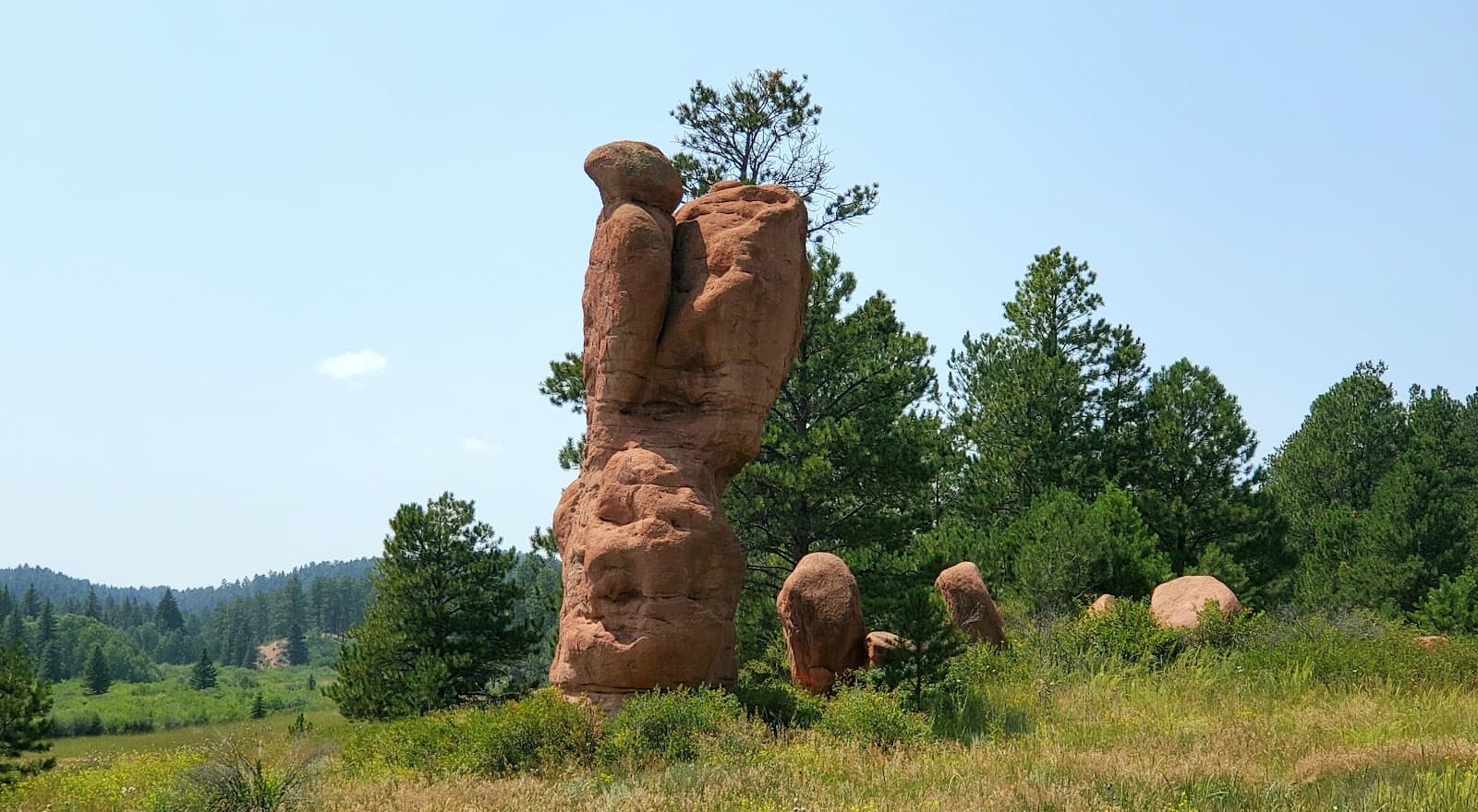
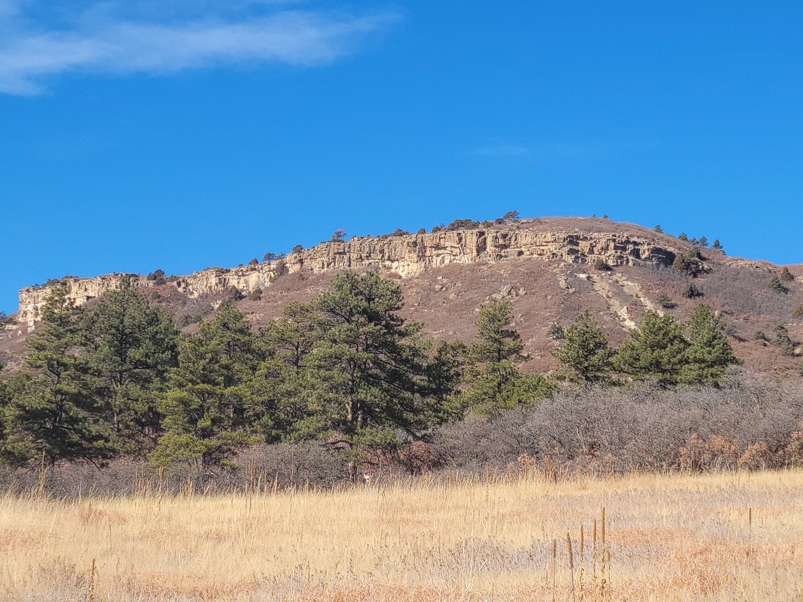
Dawson Butte Ranch Open Space Trail wraps the base of Dawson Butte itself, a 7,500-foot mesa that sits between Castle Rock and Larkspur on the west side of I-25. The 5-mile loop, marked from the trailhead at 1923 Tomah Road, is a Douglas County Open Space property and one of the better-maintained trails in the southern half of the county. AllTrails has it at 4.7 stars across 2,800+ reviews, which is unusually high for a flat suburban trail.
The terrain is the selling point. A 380-foot total elevation gain across 5 miles means you barely climb; the trail is a flat-to-rolling singletrack that wraps the butte through a mix of pine, gambel oak, and open meadow. In late May and early June the meadows fill with paintbrush, lupine, and the early wildflower mix that you usually have to drive into the foothills to find. The shade coverage is better than most DougCo trails; pines on the west and south arcs hold the cool through summer.
This is the trail to send beginners on. Five miles is a real hike but the lack of vertical means almost any fitness level can finish it in 90-120 minutes. Trail runners use it as a tempo day. Mountain bikers ride it (it's also marked for bikes; expect company in the evenings). Dogs are allowed on leash, which makes it one of the few longer DougCo trails that's dog-legal (Waterton bans dogs entirely).
The weak spot: parking is a single-lot setup at the trailhead, and on summer Saturday mornings between 8 and 11am it fills. The drive in on Tomah Road is unpaved for the last quarter-mile; passable in any car but loose-gravel slow.
Know before you go
- •A flat 5-mile loop with kids, beginners, or out-of-town visitors
- •Late May / early June for the wildflower bloom
- •Trail-running tempo days (the surface stays good year-round)
- •On-leash dog walks (allowed here; not at Waterton)
Open dawn to dusk year-round. Spring and fall are peak. Summer mornings before 9am beat the heat; afternoon thunderstorms in July-August are predictable. Winter is hikeable most days; the trail is south-facing in stretches and dries fast after snow.
Park before 8am on summer weekends, or come on a weekday. The lot only holds about 30 cars and there's no overflow option. The loop runs counter-clockwise by convention (most people go that way); going clockwise gives you the wildflower meadow as your last mile, which is the more rewarding direction for photos.
The last quarter-mile of Tomah Road is unpaved. Most cars handle it fine but it's loose gravel, slow. No water at the trailhead; bring your own. Mountain bikers share the trail in the evenings; if you're walking with kids or a dog, mornings are calmer.
Single trailhead lot at 1923 Tomah Road, free, holds ~30 cars. Fills by 9am on summer Saturdays. Last quarter-mile of road is unpaved gravel, passable in any vehicle.
Featured in our coverage
Best for
Details
- Monday: 6:00 AM – 9:00 PM
- Tuesday: 6:00 AM – 9:00 PM
- Wednesday: 6:00 AM – 9:00 PM
- Thursday: 6:00 AM – 9:00 PM
- Friday: 6:00 AM – 9:00 PM
- Saturday: 6:00 AM – 9:00 PM
- Sunday: 6:00 AM – 9:00 PM